We have recently concluded our unit on maps. The first grade curriculum requires that the students know their planet, continent, country, state and city. They must also know map symbols, cardinal directions, land formations, the state's capital and the country's capital. Needless to say, this is a very challenging unit for some first graders. It requires them to think "out of the box" in terms of their locality. Most first graders don't comprehend "beyond" where they are at the present moment, and truthfully, some have never even heard of any place beyond their home.
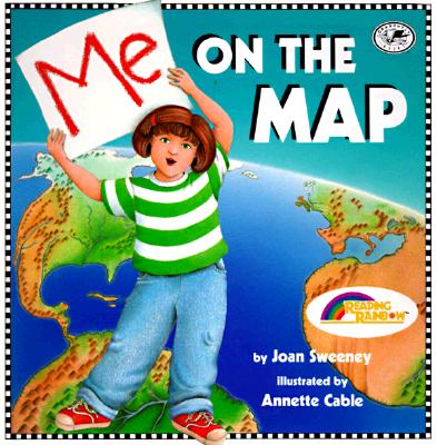
So, to tie this unit together, I read the book
Me On The Map. The book is about a little girl who begins telling the story about where she is presently at (in her bedroom). She then goes to her neighborhood, then to her city, then to her state, on to her country, then to her continent and finally her planet. By the end of the book, the little girl goes backwards through the localities and ends up back in her bedroom. I love this book because it shows the students how their location can start "small" and end up "huge." It also shares how we are a part of a great big world!
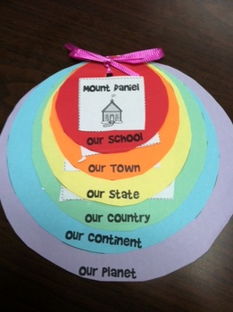
To tie all of these facts together, our class created our own "Me On The Map" student-made booklet. We started small (our house), then grew to our city , then our state, then our continent using the world map, then our planet. Each time our location grew and got bigger, the circle that we pasted our location on got bigger. Then I bound all of our circles together. The children loved the booklet. It was a great visual for them to see how, as the circles got larger each time, so did the size of their location. This was a wonderful teaching tool to tie all of our studies together! I can thank Pinterest for this wonderful idea! Enjoy the visuals below!